
What Should a Road Dilapidation Survey Measure Before Construction Starts?

A road dilapidation survey before construction should establish a measurable record of existing pavement condition. Depending on the project, this may include surface distress, rutting, ride condition, drainage and, where required, structural response and pavement layer information.
Tie each measurement to a consistent location reference so you can assess the same pavement section during and after construction.
This matters because construction can change how an existing road is loaded and used. Increased heavy vehicle movements, concentrated turning at site accesses and temporary drainage changes can all coincide with pavement deterioration. Without a reliable baseline, it becomes much harder to determine what changed later.
A useful survey therefore does more than photograph visible defects. It establishes a repeatable pavement condition baseline that can be compared with surveys during and after construction.
1. Surface distress: cracking, potholes and patching
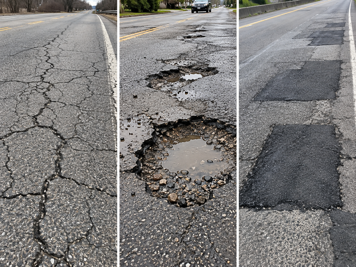
Record the existing surface condition before construction begins.
This may include cracking, potholes, ravelling, patching and other visible defects.
For cracking, the useful question is not simply whether cracks are present. Engineers need to know where they are, how extensive they are and how severe they are.
Depending on the survey method, cracking can be recorded as a percentage of the surveyed area and linked to chainage and imagery.
For example, if cracking increases from an illustrative 4% to 8% within the same section, the change can be quantified rather than described through photographs alone.
LCMS2 can support this type of pavement condition survey by collecting high-resolution surface data and imagery at traffic speed.
2. Rutting and pavement deformation
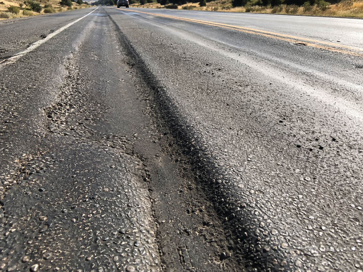
Construction traffic can apply repeated heavy wheel loads along the same paths, making rutting an important baseline measurement.
Rut depth is reported in millimetres and can be compared across repeat surveys.
For example, an illustrative section recorded 5 mm of rutting before construction and 10 mm in a later survey, showing measurable deformation.
That does not establish why the rutting increased, but it gives engineers a defined change to investigate.
Other deformation may include depressions, shoving and local settlement, particularly near intersections, site accesses and areas subject to repeated braking or turning.
3. Ride condition and longitudinal profile

A pavement can deteriorate without developing obvious cracking or potholes immediately.
Changes in longitudinal profile can also affect ride quality. The International Roughness Index, or IRI, commonly quantifies this and is reported in m/km.
For example, an illustrative section that changes from 2.0 m/km to 2.7 m/km during monitoring shows a measurable change in ride condition.
That result still requires engineering interpretation, but it provides another objective indicator of how the pavement is evolving.
LCMS2 can collect longitudinal profile and IRI data alongside other pavement condition measurements, allowing you to review several indicators together.
4. Structural response where required
Not every road dilapidation survey requires structural testing.
However, where pavement capacity is uncertain or heavy construction traffic is expected, surface condition alone may not provide enough information.
A Falling Weight Deflectometer applies a known load to the pavement and measures deflection in micrometres.
This can help assess how the pavement responds under load and may be useful where a road appears visually sound but underlying structural capacity is uncertain.
Repeat FWD results should be interpreted carefully. Factors such as applied test load, asphalt temperature, seasonal moisture and test location can all affect comparison.
5. Pavement layer information
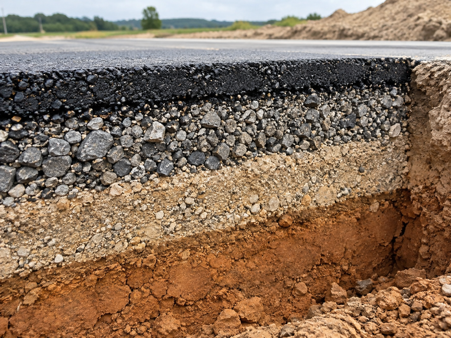
Where pavement construction is uncertain, Ground Penetrating Radar can provide additional information about pavement layer thickness and variability.
This can be valuable where sections of the same road were constructed at different times or with different pavement configurations.
Layer information can help explain why two sections exposed to similar construction traffic respond differently.
It may also identify locations where further investigation is warranted.
6. Drainage and pavement edges
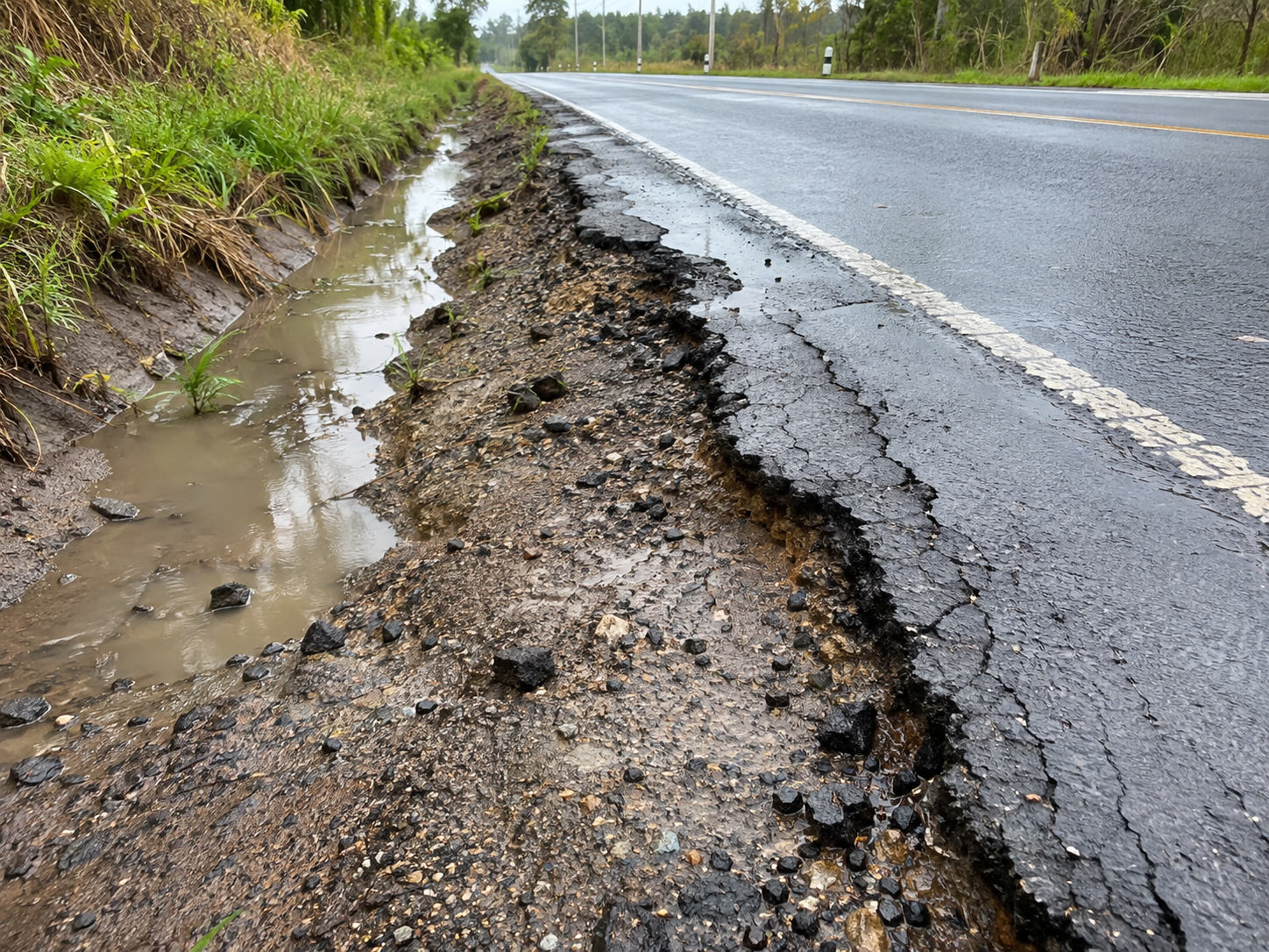
Water can have a significant influence on pavement performance, so a dilapidation assessment should consider drainage as well as the trafficked surface.
Relevant observations may include:
Ponding
Blocked drainage paths
Damaged shoulders
Edge deterioration
Locations where water may enter the pavement
Construction activity can also alter drainage behaviour through temporary works, excavation, stockpiling or changes to roadside flow paths.
If deterioration later develops in these areas, a documented baseline provides important context.
Why location referencing matters in construction traffic monitoring
Measurements become much more useful when engineers know exactly where they were recorded.
Baseline surveys should use consistent spatial referencing such as:
Chainage
Lane and direction
Wheel path
Intersection or access location
GPS-referenced imagery
Defined survey limits
This allows later surveys to compare the same pavement section rather than relying only on overall network averages.
Why repeat pavement surveys must be comparable
A baseline is only useful if it can be reproduced.
Repeat surveys should use consistent routes, lanes, directions, chainage and measurement methods wherever practicable.
The closer the survey conditions are matched, the stronger the comparison becomes, particularly when relatively small changes are being assessed.
A measured change is not a proven cause
If cracking increases, rutting deepens, or ride condition worsens during a construction project, the survey demonstrates a change in pavement condition.
It has not necessarily established that construction traffic caused the change.
Engineering interpretation may also need to consider:
Traffic exposure
Rainfall
Drainage
Seasonal moisture
Existing defects
Previous maintenance
Pavement structure
Differences between survey conditions
Monitoring provides a reliable evidence base to investigate these questions.
From baseline to construction monitoring
A practical monitoring sequence is:
Before construction: establish existing pavement condition.
During construction: repeat the relevant measurements at agreed intervals.
After construction: compare the final condition with the baseline and interim surveys.
The result is a clearer record of where pavement condition changed, how much it changed and where further engineering investigation may be required.
Establishing the baseline before mobilisation provides a stronger foundation for later monitoring, engineering discussions and pavement treatment decisions.
PMS uses LCMS2, FWD and GPR, together with visual assessment and engineering interpretation, to support pavement condition assessment and construction traffic monitoring.